A major winter storm is hitting the South, bringing snow and ice, causing significant travel disruptions and power outages, just one day after it impacted the Plains.
The storm had already caused widespread closures in the South on Friday, with schools, government offices, and businesses shutting down as a state of emergency was declared in several areas, leading to travel chaos.
Over 3,000 flights across the US were canceled on Friday, marking the worst day for flight cancellations since July. This storm affected nearly all major airports in the South.
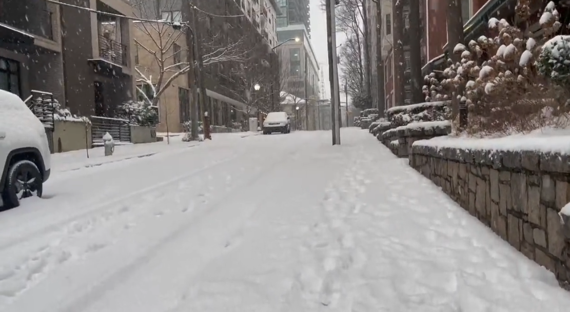
Snowfall covered much of Tennessee on Friday afternoon, including cities like Memphis and Nashville, while parts of the Southeast, including Atlanta, saw a mix of snow and sleet. This was Atlanta’s biggest snowfall in nearly seven years.
Farther west, the storm continued overnight, creating conditions far from a winter wonderland. By Friday evening, over 135,000 homes and businesses in Georgia, Texas, and Arkansas were without power due to freezing temperatures, with Georgia experiencing the majority of the outages.

Since Thursday, snow has accumulated in these regions, with areas north of the Dallas-Ft. Worth metro receiving up to 8 inches. In the Texas Panhandle near Amarillo, up to a foot of snow fell, and Dallas saw 2 to 4 inches, marking the city’s biggest snowstorm in four years. Southeastern Oklahoma recorded 6 to 10 inches of snow, while central Arkansas received over a foot of snow.
The severe weather has made travel hazardous, with reports of jackknifed tractor-trailers and stranded vehicles in northern Texas and southern Oklahoma. In southern Oklahoma, all southbound lanes of Interstate 35 near Davis became completely congested after a crash caused a shutdown.
The Oklahoma Highway Patrol responded to over 500 traffic accidents on Thursday, including 85 crashes with injuries.
In Arkansas, Governor Sarah Sanders activated the National Guard to help stranded drivers.
By Friday morning, roads in parts of Alabama were treacherous and impassable, as state officials reported. All city roads in Calhoun County were closed due to snow and ice covering the streets.
Mississippi also saw multiple crashes and slide-offs, according to the state’s highway patrol.
The storm is expected to have at least moderate impacts across parts of the South on Friday, according to the Winter Storm Severity Index. Some areas may experience major disruptions, creating dangerous travel conditions and significant daily life interruptions. This includes Atlanta, which saw icy sleet early Friday morning, later transitioning into snow.
By mid-morning, reports showed 1 to 3 inches of snow and sleet in the Atlanta metro area. The city will face mixed precipitation throughout the day, and the icy conditions could lead to power outages as well as hazardous travel.
As temperatures dip below freezing after sunset, slush and standing water on North Georgia roads will freeze again, creating dangerous travel conditions into Saturday.
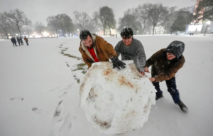
Even a small amount of ice, such as a thin layer or just a tenth of an inch, can be extremely dangerous. It can turn paved surfaces into slippery rinks, causing people to slip and vehicles to lose control, as seen in the central US over the weekend. Ice can also weigh down power lines, leading to power outages.
In response to the storm, all government offices in Atlanta were closed on Friday, and the city opened several warming centers, as announced in a news release.
Georgia officials stated that they learned valuable lessons from the notorious 2014 “Snowpocalypse,” which left hundreds of cars stranded on icy Atlanta highways.
“We got ahead of the storm,” said Governor Brian Kemp. “It’s difficult to keep up with Mother Nature, but we are doing our best.”
Before the first snowflake fell on Friday, about 20,000 miles of roadway were treated with brine, according to the state Department of Transportation, and more than 300 plows were deployed to clear highways.
Despite these efforts, “numerous” crashes and incidents were reported on Georgia’s interstates and state routes, with the Department of Transportation warning that road conditions were deteriorating and considered hazardous for travel.
The Georgia Department of Public Safety received over 1,000 weather-related service calls on Friday, with 225 crashes reported.
By 5 p.m. ET, over 590 flights (56%) departing from Atlanta’s Hartsfield-Jackson International Airport were canceled. This airport, the busiest in the world by passenger traffic, serves as a major hub for Delta Air Lines.
A ground stop was issued at the Atlanta airport on Friday afternoon at the request of the airline.
In addition, two of American Airlines’ major hubs, Charlotte Douglas International Airport and Dallas Fort Worth International Airport, also had numerous flight cancellations, with 43% of departing flights canceled in Charlotte and 23% canceled at DFW.
On Friday afternoon, messy snow and an icy mix arrived in parts of the Carolinas, affecting those states and nearby regions in the mid-Atlantic through Friday night.
Charlotte, North Carolina, which hasn’t seen measurable snow in nearly two years, is expected to break that streak. Snowfall totals could reach 1 to 3 inches across much of the state, with some areas in western North Carolina’s mountains receiving more than half a foot by Saturday morning.
Western North Carolina is still recovering from the devastation caused by Hurricane Helene in September, and Governor Josh Stein acknowledged the added difficulty the storm brings to those still recovering. “We know that those still recovering from Hurricane Helene are especially going to feel the impacts of the storm,” he said on Friday. Crews began preparations for the storm on Wednesday and have been addressing winter weather in the mountains for several weeks.
Due to the storm, all disaster recovery centers for Hurricane Helene in the region will be closed on Friday and Saturday but will reopen on Monday. Over 100 National Guard troops were stationed in western and central North Carolina ahead of the storm and are ready to assist, according to officials.
In addition, snow began falling on Friday in Kentucky, Missouri, Illinois, and Indiana as a storm from Canada interacted with the southern storm, pulling moisture north. A widespread 1 to 3 inches of snow is expected in Kentucky and parts of the Midwest through Friday night.
The Northeast will also experience 1 to 3 inches of snow Friday night into Saturday morning.