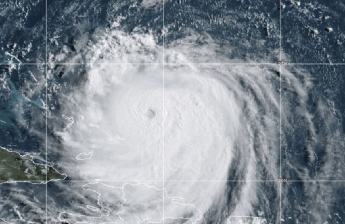
Hurricane Erin dropped to a Category 3 storm on Sunday, even as its outer bands continued to batter the Virgin Islands and Puerto Rico with strong winds and heavy rain.
Though the storm’s peak winds have decreased, its overall size has expanded, prompting forecasters to issue tropical storm warnings for the Turks and Caicos Islands and a watch for the southeastern Bahamas.

While Erin isn’t expected to make direct landfall along the U.S. East Coast, its growing size could still cause dangerous rip currents along the Southeast shoreline. The National Weather Service also warned that gusty winds and tidal flooding could damage or wash out sections of the highway that links the North Carolina Outer Banks by midweek.
Forecasters noted that Bermuda could also experience similar effects as Erin is predicted to shift north and then northeast in the coming days.
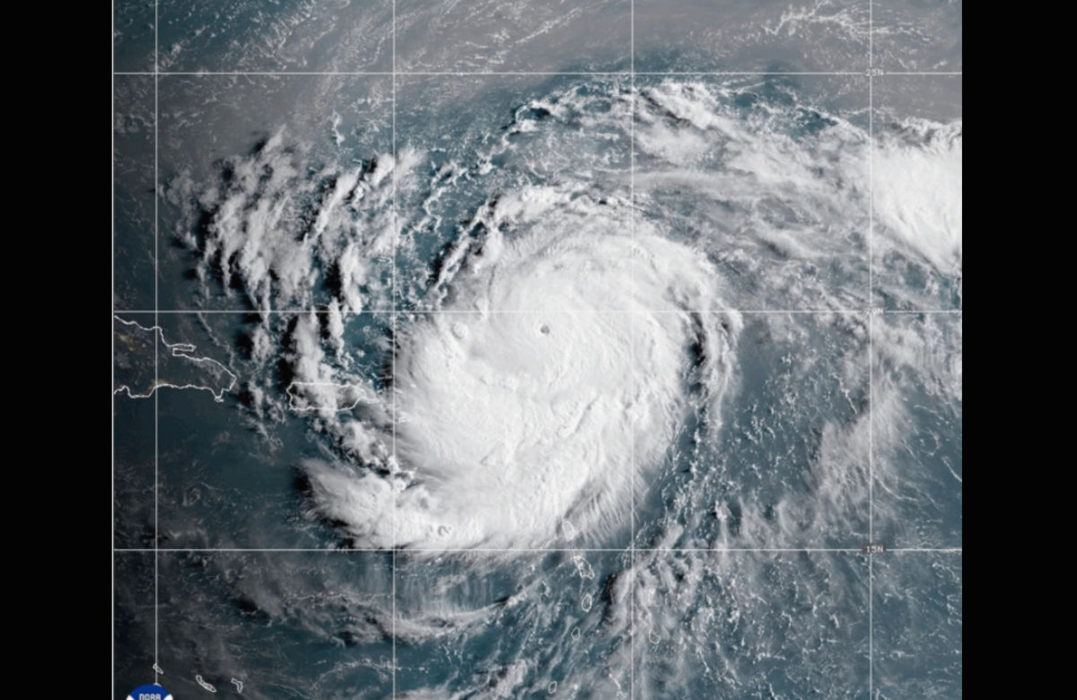
Erin, the Atlantic’s first hurricane of the 2025 season, reached powerful Category 5 intensity on Saturday with top winds of 160 mph (260 kph) before beginning to weaken.

By late Sunday morning, the hurricane’s maximum sustained winds had decreased to 125 mph (205 kph), according to the National Hurricane Center in Miami. The weakening was attributed to internal structural changes, though Erin is still expected to remain a strong storm for several more days.
“This remains a major hurricane,” said Richard Pasch of the National Hurricane Center. “Its intensity may fluctuate, but it continues to pose serious danger.”
At that time, the storm’s center was located about 200 miles (320 kilometers) north-northwest of San Juan, Puerto Rico, and around 240 miles (385 kilometers) east of Grand Turk Island. Erin was moving west-northwest at 13 mph (20 kph).
In Puerto Rico, the storm’s outer bands knocked out power to approximately 147,000 customers, according to Luma Energy, the private company responsible for the island’s electricity distribution. Officials also reported that over 20 flights were canceled due to the weather.
Swells generated by Erin are expected to impact the Virgin Islands, Puerto Rico, Hispaniola, and the Turks and Caicos over the next few days, potentially causing hazardous surf and coastal flooding.
Tropical storm warnings indicate that tropical storm conditions are likely within 24 hours. In this case, affected areas should prepare for continued heavy rainfall. Forecasts predict 3 to 6 inches (7.6 to 15 centimeters) of rain across the Virgin Islands and Puerto Rico, with isolated areas possibly seeing up to 8 inches (20 centimeters).
In addition, the government of the Bahamas issued a tropical storm watch for its southeastern region.
Climate scientists have increasingly connected the rapid intensification of Atlantic hurricanes to climate change. Warmer ocean temperatures and higher levels of atmospheric moisture are enabling storms to strengthen faster and produce heavier rainfall, making hurricanes like Erin even more dangerous.
Also Read:
Hurricane Erin Approaches, Bringing Heavy Rain to Puerto Rico and the Virgin Islands
Tropical Storm Erin Develops in Atlantic as Hurricane Henriette Gains Strength in Pacific