Hurricane Milton: Rapid Intensification
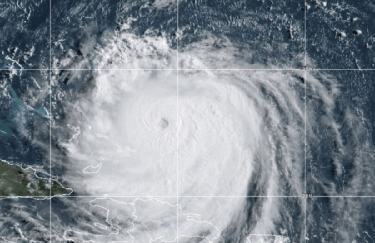
Hurricane Milton has rapidly intensified in the southern Gulf of Mexico, moving towards Florida. Initially a tropical storm on Sunday morning, it escalated to a Category 5 hurricane within just 24 hours. As of early Tuesday, it has downgraded to a strong Category 4.
National Hurricane Center Updates
The National Hurricane Center continuously updates its public advisories, including adjustments to Milton’s projected path. Currently, the forecast indicates that Milton is aimed at the western coast of Florida. However, the exact position of the storm’s center, or “eye,” will play a crucial role in determining the severity of its impact on the Tampa Bay area.

Hurricane Milton’s Intensification and Storm Surge Impact
As Hurricane Milton intensified into a major hurricane, wind speeds soared above 180 mph on Monday. This escalation has heightened the storm surge forecast for all coastal areas, particularly along Florida’s Gulf Coast.
Updated Storm Surge Forecast
In light of Milton’s increased intensity, the National Hurricane Center has revised its peak storm surge forecast. The anticipated inundation for the area from Anclote River to Tampa Bay has risen from 8-12 feet to 10-15 feet. This adjustment reflects the storm’s escalating maximum sustained wind speeds.


The “Dirty Side” of the Storm
The eastern side of the hurricane’s eye is known as the “dirty side,” where wind speeds are typically strongest. As the forecast track moves northward, this “dirty side” will cover Tampa Bay, significantly increasing the risk of storm surge in that region.
Shallow Waters Heighten Surge Risks
Florida’s Gulf side features shallower waters compared to the Atlantic, which can amplify the effects of storm surge on nearby communities.
Storm Surge Impact and Warnings for Hurricane Milton
The National Hurricane Center (NHC) warned that the deepest water from Hurricane Milton will occur along the immediate coast, particularly south of the landfall point. This surge will be accompanied by large and dangerous waves. The extent of surge-related flooding will depend on the timing of the surge relative to the tidal cycle and can vary significantly over short distances.
Ongoing Threat of Intensity Fluctuations
In a subsequent advisory, the NHC indicated that while fluctuations in Milton’s intensity are anticipated, the hurricane is expected to remain extremely dangerous up until landfall in Florida.
Evacuation Orders Urged for Residents and Visitors
All coastal residents and visitors are strongly advised to follow local officials’ evacuation orders currently in effect to ensure their safety.