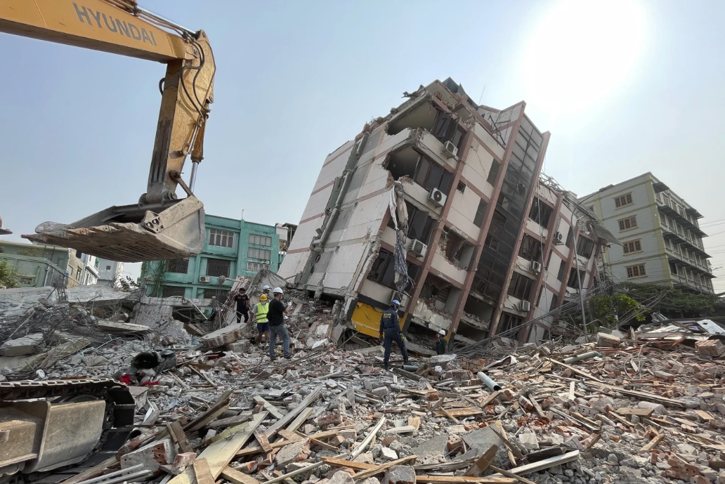
Just after sunrise on Saturday, a satellite focused its long-range camera on Mandalay, Myanmar, not far from the epicenter of the devastating 7.7 magnitude earthquake that struck the country’s second-largest city on Friday. The goal was to capture images that, when combined with artificial intelligence, could help relief organizations quickly assess the extent of damage—identifying collapsed buildings and areas where help was most urgently needed.
Initially, the high-tech computer vision system faced a major hurdle: thick clouds obscured the view. “The biggest challenge in this particular case was the clouds,” said Juan Lavista Ferres, Microsoft’s chief data scientist. “There’s no way to see through clouds with this technology.”

Eventually, the clouds cleared, and a few hours later, another satellite captured the necessary aerial images. These were quickly sent to Microsoft’s philanthropic AI for Good Lab, where a team was already prepared to analyze the data, even though it was late at night in Redmond, Washington.
While the AI for Good Lab has previously supported disaster responses—such as tracking catastrophic flooding and wildfires—this situation required a customized AI model. “The Earth is too different, the natural disasters are too different, and the imagery we get from satellites is just too different to work in every situation,” Lavista Ferres explained. Unlike wildfires, which tend to spread predictably, earthquakes can cause widespread and unpredictable damage across an entire city, making it more challenging to determine where help is needed most.
After processing the satellite images, the AI identified 515 buildings in Mandalay with between 80% and 100% damage and another 1,524 buildings with 20% to 80% damage. This detailed assessment not only highlighted the scale of the destruction but also pinpointed specific areas where aid was most urgently required.

“This is critical information for teams on the ground,” Lavista Ferres said.
Microsoft emphasized that while the AI-generated analysis provides an important preliminary guide, it should be verified through on-the-ground assessments for a complete understanding of the situation. In the meantime, this data has been shared with humanitarian organizations to support their relief efforts.
Satellites have captured images of around a dozen locations in Myanmar and Thailand since the earthquake occurred.