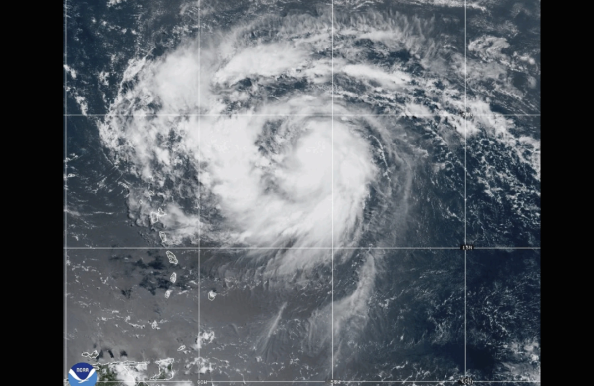
Erin intensified into a hurricane on Friday as it neared the northeast Caribbean, prompting warnings about potential flooding and landslides. Although the system is expected to stay over open waters, tropical storm watches have been issued for several islands, including Anguilla, Barbuda, St. Martin, St. Barts, Saba, St. Eustatius, and St. Maarten.
Heavy rainfall is projected to begin late Friday across Antigua and Barbuda, the U.S. and British Virgin Islands, and parts of southern and eastern Puerto Rico. Rainfall totals could reach up to 4 inches (10 centimeters), with localized areas seeing as much as 6 inches (15 centimeters), according to the National Hurricane Center based in Miami.

Forecasters also cautioned about hazardous swells generated by the storm.
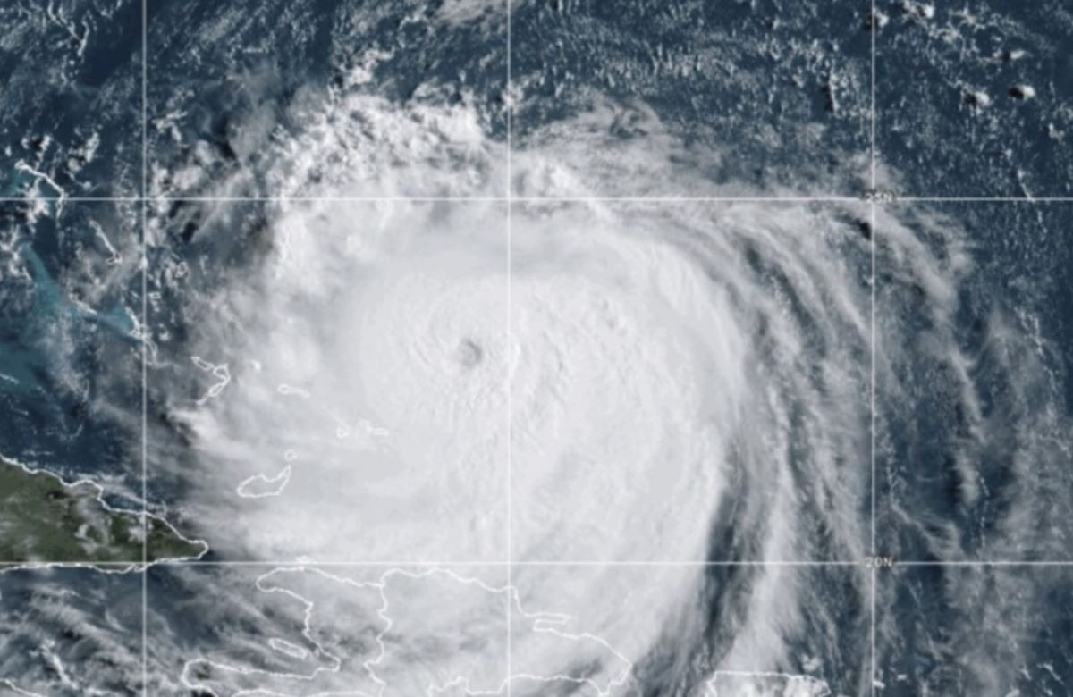
As of Friday, Erin was located about 460 miles (740 kilometers) east of the Northern Leeward Islands. It had maximum sustained winds of 75 mph (120 kph) and was moving west-northwest at 18 mph (30 kph).
Hurricane specialist and storm surge expert Michael Lowry noted that Erin is expected to make a sharp northeast turn, steering it between the U.S. and Bermuda. “Forecasts still keep the storm safely east of the mainland U.S.,” he said.

Erin, the first hurricane of the Atlantic season, is expected to strengthen into a major Category 3 storm by late this weekend. However, the hurricane center emphasized that there remains some uncertainty about potential impacts in the Bahamas, Bermuda, and along parts of the U.S. East Coast in the longer term.
Next week, dangerous surf and rip currents are anticipated along the U.S. East Coast. Waves up to 15 feet (5 meters) could strike portions of the North Carolina coastline, potentially causing beach erosion, according to AccuWeather.
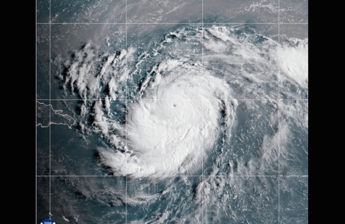
“Erin is on track to rapidly intensify into a powerful Category 4 hurricane as it moves through very warm Atlantic waters,” said Alex DaSilva, AccuWeather’s lead hurricane expert. “Water temperatures, both at the surface and deeper below, are significantly higher than historical averages.”
Erin marks the fifth named storm of this Atlantic hurricane season, which runs from June 1 through November 30. This season is expected to be particularly active, with forecasts calling for six to ten hurricanes—three to five of which could become major hurricanes with wind speeds exceeding 110 mph (177 kph).
Also Read:
Tropical Storm Erin Develops in Atlantic as Hurricane Henriette Gains Strength in Pacific
Hurricane Iona quickly develops in central Pacific, remains no threat to Hawaii